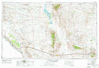
1954 Map of Van Horn
USGS Topo · Published 1977About this map
The Guadalupe Mountains dominate this Trans-Pecos landscape, featuring the high point at Guadalupe Peak and the landmark El Capitan. This region is defined by its dramatic elevation changes and sparse settlement patterns, where vast basins like Crow Flats and Wildhorse Mesa are punctuated by steep ranges including the Sierra Diablo and Apache Mountains. To the south and west, the Rio Grande forms the international boundary with Chihuahua, Mexico, serving as a vital corridor for the Southern Pacific and Texas and Pacific railroads.
Find a feature on this map
102 named features on this map. Tap any name to fly to it.
Don’t see what you’re looking for? This feature index may not catch every label — zoom into the map to look around manually.
Map Details
Editions of this 1954 Van Horn Map
2 editions found

Other maps of this area

1892 · Chispa
USGS Topo · 1:125,000

1894 · Fort Hancock
USGS Topo · 1:125,000

1894 · Valentine
USGS Topo · 1:125,000

1894 · Fort Davis
USGS Topo · 1:125,000

1895 · Chispa
USGS Topo · 1:125,000

1895 · Sierra Blanca
USGS Topo · 1:125,000

1896 · El Paso
USGS Topo · 1:125,000

1896 · Rio Grande
USGS Topo · 1:125,000

1897 · Valentine
USGS Topo · 1:125,000

1897 · Fort Davis
USGS Topo · 1:125,000