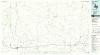
1985 Map of Van Horn
USGS Topo · Published 1993About this map
Van Horn serves as the primary hub of this West Texas landscape, situated at the junction of the Texas and Pacific and Missouri Pacific railroads. The map illustrates a high-desert environment where drainage patterns like Wild Horse Draw and Sacaton Draw define the movement of water through the basin. The terrain is marked by significant uplifts, including the Sierra Diablo to the northwest and the Apache Mountains toward the center, which dictate the paths of early transportation routes. Local industry is evidenced by the Marble Mine near the Diablo Rim, while the presence of the County Airfield near Van Horn signals the region's mid-20th-century modernization. Smaller settlements like Allamore and Kent punctuate the rail lines, providing essential points of reference for genealogists tracing family history along these historic transit corridors.
Find a feature on this map
80 named features on this map. Tap any name to fly to it.
Don’t see what you’re looking for? This feature index may not catch every label — zoom into the map to look around manually.
Map Details
Editions of this 1985 Van Horn Map
3 editions found
Other maps of this area

1892 · Chispa
USGS Topo · 1:125,000

1894 · Valentine
USGS Topo · 1:125,000

1894 · Fort Davis
USGS Topo · 1:125,000

1895 · Chispa
USGS Topo · 1:125,000

1895 · Sierra Blanca
USGS Topo · 1:125,000

1897 · Valentine
USGS Topo · 1:125,000

1897 · Fort Davis
USGS Topo · 1:125,000

1897 · Eagle Mountain
USGS Topo · 1:125,000

1897 · Chispa
USGS Topo · 1:125,000

1906 · Van Horn
USGS Topo · 1:125,000