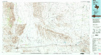
1985 Map of Van Horn
USGS Topo · Published 1985About this map
Van Horn serves as the primary hub of this West Texas landscape, situated at the junction of major travel routes and the Southern Pacific railroad. The geography is defined by a series of prominent ranges including the Sierra Diablo, the Apache Mountains, and the Wylie Mountains, which rise sharply from the arid floor of the Salt Basin. A complex network of ephemeral drainages like Wild Horse Creek and Sacaton Draw indicates the region's hydraulic character, where water flow is rare but impactful.
Find a feature on this map
86 named features on this map. Tap any name to fly to it.
Don’t see what you’re looking for? This feature index may not catch every label — zoom into the map to look around manually.
Map Details
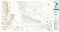
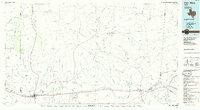
Editions of this 1985 Van Horn Map
3 editions found
Other maps of this area

1892 · Chispa
USGS Topo · 1:125,000

1894 · Valentine
USGS Topo · 1:125,000

1894 · Fort Davis
USGS Topo · 1:125,000

1895 · Chispa
USGS Topo · 1:125,000

1895 · Sierra Blanca
USGS Topo · 1:125,000

1897 · Valentine
USGS Topo · 1:125,000

1897 · Fort Davis
USGS Topo · 1:125,000

1897 · Eagle Mountain
USGS Topo · 1:125,000

1897 · Chispa
USGS Topo · 1:125,000

1906 · Van Horn
USGS Topo · 1:125,000