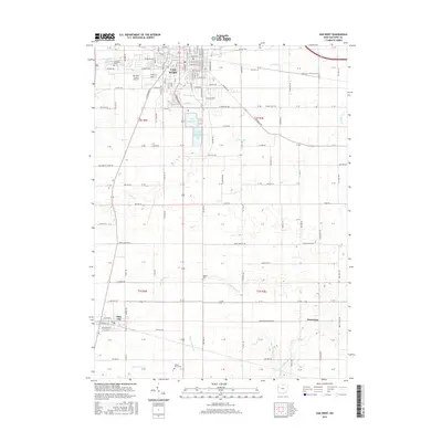
2016 Map of Van Wert
USGS Topo · Published 2016About this map
Van Wert serves as the focal point of this 2016 survey, showcasing a grid of residential and industrial development transitioning into the expansive agricultural landscape of Western Ohio. The city's infrastructure is anchored by the Van Wert County Airport and a critical water management system including the City Reservoir and Van Wert Reservoir Number One. Significant transportation arteries like the historic Lincoln Hwy cross the northern reaches, while numerous rural routes such as Middle Point Rd and Van Wert Willshire Rd connect the surrounding townships.
Find a feature on this map
93 named features on this map. Tap any name to fly to it.
Don’t see what you’re looking for? This feature index may not catch every label — zoom into the map to look around manually.
Map Details
Editions of this 2016 Van Wert Map
This is the sole edition of this map. No revisions or reprints were ever made.
Other maps of this area

1911 · Spencerville
USGS Topo · 1:62,500

1911 · Delphos
USGS Topo · 1:62,500

1914 · Celina
USGS Topo · 1:62,500

1914 · Van Wert
USGS Topo · 1:62,500

1944 · Delphos
USGS Topo · 1:62,500

1944 · Van Wert
USGS Topo · 1:62,500

1944 · Celina
USGS Topo · 1:62,500

1944 · Spencerville
USGS Topo · 1:62,500

1953 · Muncie
USGS Topo · 1:250,000

1956 · Muncie
USGS Topo · 1:250,000