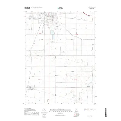
2019 Map of Van Wert
USGS Topo · Published 2019About this map
The Van Wert County Courthouse anchors this Western Ohio landscape, serving as the civic heart of a region defined by its grid-iron road network and prairie drainage systems. The city of Van Wert expands around the City Reservoir, with the historic Lincoln Hwy and the Van Wert County Airport marking its northern edges. To the south, the terrain transitions into the smaller settlements of Ohio City and Jonestown, where a series of prairie creeks including Mown Prairie Cr and Long Prairie Cr feed toward the Little Auglaize River. Genealogists will find several notable burial grounds across these townships, including Woodland Cem, Wallick Cem, and Walnut Grove Cem, providing essential anchors for family history research in this agricultural corridor.
Find a feature on this map
50 named features on this map. Tap any name to fly to it.
Don’t see what you’re looking for? This feature index may not catch every label — zoom into the map to look around manually.
Map Details
Editions of this 2019 Van Wert Map
This is the sole edition of this map. No revisions or reprints were ever made.
Other maps of this area

1911 · Spencerville
USGS Topo · 1:62,500

1911 · Delphos
USGS Topo · 1:62,500

1914 · Celina
USGS Topo · 1:62,500

1914 · Van Wert
USGS Topo · 1:62,500

1944 · Delphos
USGS Topo · 1:62,500

1944 · Van Wert
USGS Topo · 1:62,500

1944 · Celina
USGS Topo · 1:62,500

1944 · Spencerville
USGS Topo · 1:62,500

1953 · Muncie
USGS Topo · 1:250,000

1956 · Muncie
USGS Topo · 1:250,000