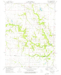
1973 Map of Vandalia Lake
USGS Topo · Published 1975About this map
The West Fork Cuivre River and its various tributaries, including Hickory Creek, define the drainage patterns across this section of Audrain and Montgomery Counties. In the early 1970s, Vandalia Lake served as a focal point for the region, complete with a dedicated Boat Ramp. The map reveals a landscape of dispersed rural settlements and agricultural infrastructure, notably at Rices Corner. Significant genealogy resources are scattered throughout the townships of Linn, Cuivre, and Upper Loutre, featuring several well-placed burial grounds and houses of worship. Local landmarks such as the West Cuivre Ch and New Providence Cem are clearly marked. Evidence of local transport and industry appears in the form of the Lemasters Landing Strip and a Claypit located near the eastern boundary, illustrating the area's economic activities during this period.
Find a feature on this map
19 named features on this map. Tap any name to fly to it.
Don’t see what you’re looking for? This feature index may not catch every label — zoom into the map to look around manually.
Map Details
Editions of this 1973 Vandalia Lake Map
2 editions found
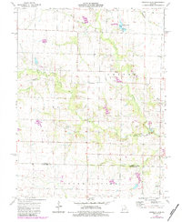
Other maps of this area

1890 · Louisiana
USGS Topo · 1:125,000

1890 · Mexico
USGS Topo · 1:125,000

1942 · Wellsville
USGS Topo · 1:62,500

1942 · Bellflower
USGS Topo · 1:62,500

1943 · Vandalia
USGS Topo · 1:62,500

1945 · Bellflower
USGS Topo · 1:62,500

1945 · Perry
USGS Topo · 1:62,500

1945 · Vandalia
USGS Topo · 1:62,500

1948 · Quincy
USGS Topo · 1:250,000

1956 · Quincy
USGS Topo · 1:250,000