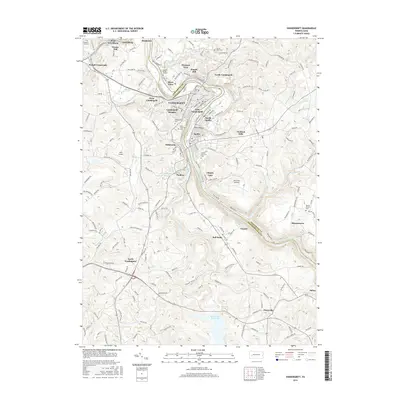
2016 Map of Vandergrift
USGS Topo · Published 2016About this map
The Kiskiminetas River carves a deep, winding path through this industrial heartland, serving as the primary border between Armstrong and Westmoreland counties. This landscape is defined by the tight-knit residential clusters of Vandergrift, Apollo, and Leechburg, which cling to the river's high banks and tiered topography. The map illustrates a dense network of local roads and suburban expansion, from Vandergrift Heights to Orchard Hills. Beyond the river towns, the terrain shifts to the expansive waters of the Beaver Run Reservoir in the south and smaller aviation facilities like Kiski Airport. For genealogists, several significant burial sites are meticulously documented, including the Saint Gertrude Cem, Apollo-Riverview Cem, and the older Keppel Burial Ground, providing a detailed record of the region's long-standing community roots.
Find a feature on this map
121 named features on this map. Tap any name to fly to it.
Don’t see what you’re looking for? This feature index may not catch every label — zoom into the map to look around manually.
Map Details
Editions of this 2016 Vandergrift Map
This is the sole edition of this map. No revisions or reprints were ever made.
Other maps of this area

1900 · Latrobe
USGS Topo · 1:62,500

1902 · Latrobe
USGS Topo · 1:62,500

1902 · Elders Ridge
USGS Topo · 1:62,500

1903 · Latrobe
USGS Topo · 1:62,500

1904 · Elders Ridge
USGS Topo · 1:62,500

1904 · Greensburg
USGS Topo · 1:62,500

1906 · Greensburg
USGS Topo · 1:62,500

1907 · Freeport
USGS Topo · 1:62,500

1909 · Freeport
USGS Topo · 1:62,500

1953 · Pittsburgh
USGS Topo · 1:250,000