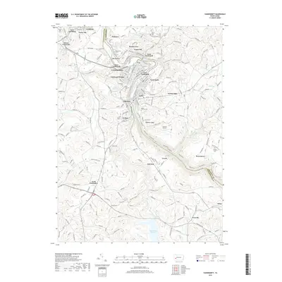
2019 Map of Vandergrift
USGS Topo · Published 2019About this map
The Kiskiminetas River carves a winding path through the heart of this landscape, separating the communities of Vandergrift and Apollo from the neighboring hills. This modern survey illustrates the dense residential and industrial footprint of the river valley, where settlements like North Vandergrift, East Vandergrift, and Oklahoma follow the water's edge. Beyond the immediate river banks, the terrain rises into the highlands of Gosser Hill and River Hill, revealing a transition to rural acreage and larger water features such as the Beaver Run Reservoir. Genealogists and local historians will find significant detail in the numerous burial sites across the quadrangle, ranging from the large Apollo-Riverview Cem and Saint Gertrude Cem to the smaller Keppel Burial Ground. The map also traces the boundary between Armstrong and Westmoreland counties, marking the jurisdictional divide that has shaped the region's development.
Find a feature on this map
187 named features on this map. Tap any name to fly to it.
Don’t see what you’re looking for? This feature index may not catch every label — zoom into the map to look around manually.
Map Details
Editions of this 2019 Vandergrift Map
This is the sole edition of this map. No revisions or reprints were ever made.
Other maps of this area

1900 · Latrobe
USGS Topo · 1:62,500

1902 · Latrobe
USGS Topo · 1:62,500

1902 · Elders Ridge
USGS Topo · 1:62,500

1903 · Latrobe
USGS Topo · 1:62,500

1904 · Elders Ridge
USGS Topo · 1:62,500

1904 · Greensburg
USGS Topo · 1:62,500

1906 · Greensburg
USGS Topo · 1:62,500

1907 · Freeport
USGS Topo · 1:62,500

1909 · Freeport
USGS Topo · 1:62,500

1953 · Pittsburgh
USGS Topo · 1:250,000