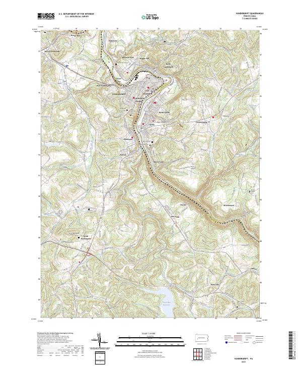
2023 Map of Vandergrift
USGS Topo · Published 2023About this map
The Kiskiminetas River snakes through the heart of this industrial and residential landscape, serving as the border between Armstrong and Westmoreland counties. The central urban corridor is densely packed with settlements including Vandergrift, East Vandergrift, North Apollo, and Apollo, showcasing a complex grid of streets like Acheson Ave and Glorietta Hill Rd. This layout reflects the historic development pattern of the Pennsylvania steel towns that flourished along the river bends.
Find a feature on this map
124 named features on this map. Tap any name to fly to it.
Don’t see what you’re looking for? This feature index may not catch every label — zoom into the map to look around manually.
Map Details
Editions of this 2023 Vandergrift Map
This is the sole edition of this map. No revisions or reprints were ever made.
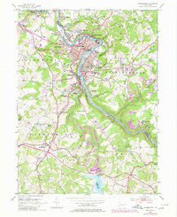
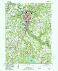
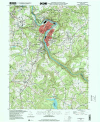
Historical Maps of Allegheny Township Through Time
4 maps found