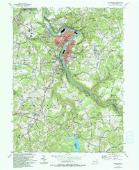
1993 Map of Vandergrift
USGS Topo · Published 1993About this map
The Kiskiminetas River carves a sharp oxbow through the heart of this industrial landscape, where the planned labor of Vandergrift and North Vandergrift meets the steep topography of the Allegheny plateau. This 1993 edition, revised from earlier mid-century data, illustrates the dense residential layout of Vandergrift Heights and East Vandergrift alongside the heavy utility footprint of the Water Filtration Plant. These communities grew around the river's bend, supported by the transportation networks of the Pennsylvania Railroad and Conrail.
Find a feature on this map
69 named features on this map. Tap any name to fly to it.
Don’t see what you’re looking for? This feature index may not catch every label — zoom into the map to look around manually.
Map Details
Editions of this 1993 Vandergrift Map
This is the sole edition of this map. No revisions or reprints were ever made.
Other maps of this area

1900 · Latrobe
USGS Topo · 1:62,500

1902 · Latrobe
USGS Topo · 1:62,500

1902 · Elders Ridge
USGS Topo · 1:62,500

1903 · Latrobe
USGS Topo · 1:62,500

1904 · Elders Ridge
USGS Topo · 1:62,500

1904 · Greensburg
USGS Topo · 1:62,500

1906 · Greensburg
USGS Topo · 1:62,500

1907 · Freeport
USGS Topo · 1:62,500

1909 · Freeport
USGS Topo · 1:62,500

1953 · Pittsburgh
USGS Topo · 1:250,000