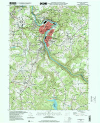
1998 Map of Vandergrift
USGS Topo · Published 2000About this map
The Kiskiminetas River carves a sharp oxbow around Vandergrift, creating a unique industrial and residential landscape at the borders of Westmoreland, Armstrong, and Allegheny counties. This late-twentieth-century survey documents a dense network of river towns including East Vandergrift, North Vandergrift, and Vandergrift Heights, alongside the neighboring borough of Apollo. The presence of the Conrail line and numerous labeled Gas Wells throughout the hillsides indicates the region's long-standing reliance on extraction and rail transport. Notable cultural landmarks like the Saints Cosmas & Damian Shrine and the Fort Hand Historical Marker provide specific points of interest for local historians. To the south, the landscape shifts toward the significant catchment of the Beaver Run Reservoir, contrasting the industrial river corridor with protected water resources and recreational spaces like Northmoreland Park.
Find a feature on this map
62 named features on this map. Tap any name to fly to it.
Don’t see what you’re looking for? This feature index may not catch every label — zoom into the map to look around manually.
Map Details
Editions of this 1998 Vandergrift Map
This is the sole edition of this map. No revisions or reprints were ever made.
Other maps of this area

1900 · Latrobe
USGS Topo · 1:62,500

1902 · Latrobe
USGS Topo · 1:62,500

1902 · Elders Ridge
USGS Topo · 1:62,500

1903 · Latrobe
USGS Topo · 1:62,500

1904 · Elders Ridge
USGS Topo · 1:62,500

1904 · Greensburg
USGS Topo · 1:62,500

1906 · Greensburg
USGS Topo · 1:62,500

1907 · Freeport
USGS Topo · 1:62,500

1909 · Freeport
USGS Topo · 1:62,500

1953 · Pittsburgh
USGS Topo · 1:250,000