
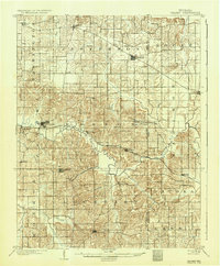
1903 Map of Velpen
USGS Topo · Published 1903About this map
Winslow and Velpen serve as primary hubs in this southern Indiana landscape surveyed at the dawn of the twentieth century. The region is defined by the winding course of the Patoka River and the South Fork Patoka River, which cut through a complex network of townships including Lockhart, Marion, and Jefferson. The industrial and transit pulse of the era is evidenced by the Southern R.R. and the St. Louis and Louisville R.R. lines, which connect small settlements like Ayrshire, Survant, and Hartwell Junc. to the wider world. Notable for local history is the presence of White Sulphur Springs and its namesake branch, suggesting the area's early connection to mineral springs. From the village of Otwell in the north to Stendal in the south, the map reveals a countryside punctuated by small post offices and communities such as Augusta, Cato, and Pikeville before modern road networks reshaped the county.
Find a feature on this map
47 named features on this map. Tap any name to fly to it.
Don’t see what you’re looking for? This feature index may not catch every label — zoom into the map to look around manually.
Map Details
Editions of this 1903 Velpen Map
2 editions found
Other maps of this area

1900 · St Meinrad
USGS Topo · 1:62,500

1900 · De Gonia Springs
USGS Topo · 1:62,500

1902 · Ditney
USGS Topo · 1:125,000

1902 · Degonia Springs
USGS Topo · 1:62,500

1902 · Boonville
USGS Topo · 1:62,500

1903 · St. Meinrad
USGS Topo · 1:62,500

1903 · Petersburg
USGS Topo · 1:62,500

1944 · Glendale
USGS Topo · 1:24,000

1944 · Monroe City
USGS Topo · 1:24,000

1945 · Sandy Hook
USGS Topo · 1:24,000