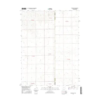
2016 Map of Venango NE
USGS Topo · Published 2016About this map
The Colorado Nebraska state line bisects this 2016 survey, defining the intersection of Sedgwick Co, Colorado, and Perkins Co, Nebraska. This high-plains landscape is organized by the Public Land Survey System, with township and range lines creating a rigid grid of sectioned agricultural territory. The terrain is characterized by subtle elevation changes and numerous small depressions, likely seasonal wetlands or playas, that dot the landscape between a network of rural routes. A series of county roads, including Co Rd 59, Co Rd 30, and Co Rd 61, provide the primary access to these remote sections. The lack of concentrated settlements or industrial markers highlights the area's specialized role in regional dryland farming or ranching during the early 21st century.
Find a feature on this map
22 named features on this map. Tap any name to fly to it.
Don’t see what you’re looking for? This feature index may not catch every label — zoom into the map to look around manually.
Map Details
Editions of this 2016 Venango NE Map
This is the sole edition of this map. No revisions or reprints were ever made.
Other maps of this area

1897 · Ogallala
USGS Topo · 1:125,000

1900 · Chappell
USGS Topo · 1:125,000

1900 · Ogallala
USGS Topo · 1:125,000

1954 · Sterling
USGS Topo · 1:250,000

1954 · Scottsbluff
USGS Topo · 1:250,000

1954 · McCook
USGS Topo · 1:250,000

1954 · North Platte
USGS Topo · 1:250,000

1956 · North Platte
USGS Topo · 1:250,000

1957 · North Platte
USGS Topo · 1:250,000

1957 · McCook
USGS Topo · 1:250,000