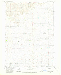
1962 Map of Venango NE
USGS Topo · Published 1963About this map
East Plainview Sch sits near the center of this 1962 landscape, serving as a primary cultural landmark in a region defined by agricultural sections and the high plains of the Highland. The terrain is marked by the intermittent depressions and ephemeral water catchments characteristic of the Colorado and Nebraska borderlands. Industrial activity is visible through scattered Gravel Pits and a specific Gravel Pit near the northern boundary, highlighting the extraction of local resources during the early 1960s. This survey, part of the Missouri River Basin development program, captures the rural grid of Sedgwick and Perkins Counties where fine red dashed lines delineate property fences across the state line.
Find a feature on this map
6 named features on this map. Tap any name to fly to it.
Don’t see what you’re looking for? This feature index may not catch every label — zoom into the map to look around manually.
Map Details
Editions of this 1962 Venango NE Map
This is the sole edition of this map. No revisions or reprints were ever made.
Other maps of this area

1897 · Ogallala
USGS Topo · 1:125,000

1900 · Chappell
USGS Topo · 1:125,000

1900 · Ogallala
USGS Topo · 1:125,000

1954 · Sterling
USGS Topo · 1:250,000

1954 · Scottsbluff
USGS Topo · 1:250,000

1954 · McCook
USGS Topo · 1:250,000

1954 · North Platte
USGS Topo · 1:250,000

1956 · North Platte
USGS Topo · 1:250,000

1957 · North Platte
USGS Topo · 1:250,000

1957 · McCook
USGS Topo · 1:250,000