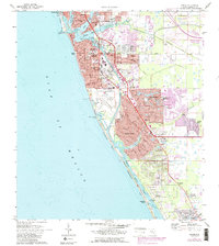
1973 Map of Venice
USGS Topo · Published 1987About this map
Venice and its surrounding coastal communities are detailed in this survey reflecting the region's mid-century development and nautical character. The shoreline is defined by barrier islands such as Casey Key and Manasota Key, separated from the mainland by the Intracoastal Waterway and a series of bays including Lyons Bay, Dona Bay, and Roberts Bay. The 1987 revision highlights significant urban expansion into areas like South Venice and Venice Gardens as the local infrastructure evolved to accommodate a growing population.
Find a feature on this map
77 named features on this map. Tap any name to fly to it.
Don’t see what you’re looking for? This feature index may not catch every label — zoom into the map to look around manually.
Map Details
Editions of this 1973 Venice Map
3 editions found
Other maps of this area

1943 · Laurel
USGS Topo · 1:24,000

1944 · Bird Keys
USGS Topo · 1:31,680

1944 · Lower Myakka Lake
USGS Topo · 1:31,680

1944 · Myakka River
USGS Topo · 1:31,680

1944 · Laurel
USGS Topo · 1:31,680

1944 · Venice
USGS Topo · 1:31,680

1956 · Englewood
USGS Topo · 1:24,000

1956 · Tampa
USGS Topo · 1:250,000

1956 · Charlotte Harbor
USGS Topo · 1:250,000

1957 · Englewood NW
USGS Topo · 1:24,000