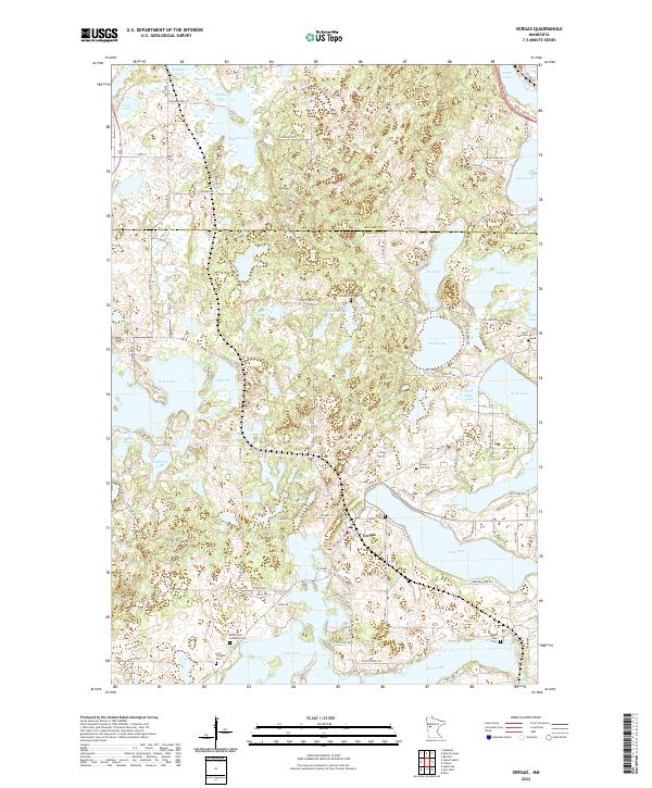
2022 Map of Vergas
USGS Topo · Published 2022About this map
Vergas serves as the central hub of this lake-heavy portion of the Otter Tail and Becker County line. The landscape is defined by an intricate network of glacial lakes, ranging from the large Loon Lake and Long Lake to smaller bodies like Scalp Lake and Schrams Lake. This geography has historically dictated the settlement patterns and road networks, with winding routes like Sybil Shores Dr and Jolly Fisherman Rd skirting the water's edge to reach lakeside properties.
Find a feature on this map
105 named features on this map. Tap any name to fly to it.
Don’t see what you’re looking for? This feature index may not catch every label — zoom into the map to look around manually.
Map Details
Editions of this 2022 Vergas Map
This is the sole edition of this map. No revisions or reprints were ever made.
Other maps of this area

1912 · Vergas
USGS Topo · 1:62,500

1915 · Perham
USGS Topo · 1:62,500

1915 · Vergas
USGS Topo · 1:62,500

1953 · Brainerd
USGS Topo · 1:250,000

1957 · Brainerd
USGS Topo · 1:250,000

1958 · Brainerd
USGS Topo · 1:250,000

1959 · Rochert
USGS Topo · 1:24,000
1959 · Audubon
USGS Topo · 1:24,000
1959 · Detroit Lakes
USGS Topo · 1:24,000

1965 · Brainerd
USGS Topo · 1:250,000