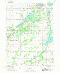
1967 Map of Vicksburg
USGS Topo · Published 1969About this map
The village of Vicksburg serves as the primary hub in this late 1960s survey, situated at the junction of the Grand Trunk Road and the Penn Central railroad lines. To the south, the landscape is defined by the winding course of the Portage River and a dense chain of glacial lakes, including Barton Lake, Kimble Lake, and Portage Lake. This region straddles the boundary of Kalamazoo and St. Joseph counties, characterized by a mix of agricultural plots and small industrial operations like the numerous Gravel Pits and Marl Pits that dot the lakeside terrain.
Find a feature on this map
57 named features on this map. Tap any name to fly to it.
Don’t see what you’re looking for? This feature index may not catch every label — zoom into the map to look around manually.
Map Details
Editions of this 1967 Vicksburg Map
3 editions found
Other maps of this area

1914 · Three Rivers
USGS Topo · 1:62,500

1916 · Three Rivers
USGS Topo · 1:62,500

1918 · Leonidas
USGS Topo · 1:62,500

1922 · Schoolcraft
USGS Topo · 1:62,500

1943 · Three Rivers
USGS Topo · 1:62,500

1943 · Schoolcraft
USGS Topo · 1:62,500

1944 · Leonidas
USGS Topo · 1:62,500

1947 · Leonidas
USGS Topo · 1:62,500

1950 · Leonidas
USGS Topo · 1:62,500

1953 · Fort Wayne
USGS Topo · 1:250,000