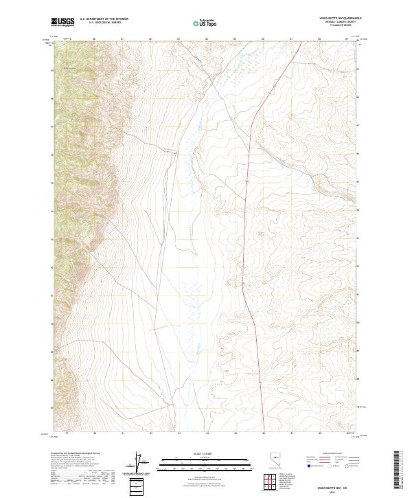
2021 Map of Vigus Butte NW
USGS Topo · Published 2021About this map
The valley floor and mountain slopes of Lander County are dominated here by the meandering path of the Reese River. This high-desert landscape is defined by its drainage patterns, where seasonal flows like Silver Cr descend from the higher elevations to the east. Near the northwestern corner, the Ravenswood area sits at the base of the foothills, accessible via the Ravenswood road that tracks along the western edge of the valley. A reliable water source in this arid terrain is found at Garden Spring, a critical landmark for local land use and hydrology. The map clearly delineates the Public Land Survey System grid, including townships t22n r42e and t21n r43e, which organize the sparsely populated Great Basin ranching and mining country.
Find a feature on this map
11 named features on this map. Tap any name to fly to it.
Don’t see what you’re looking for? This feature index may not catch every label — zoom into the map to look around manually.
Map Details
Editions of this 2021 Vigus Butte NW Map
This is the sole edition of this map. No revisions or reprints were ever made.
Other maps of this area

1955 · Millett
USGS Topo · 1:250,000

1959 · Millett
USGS Topo · 1:250,000

1969 · Manhattan Mtn
USGS Topo · 1:24,000

1969 · Gilbert Creek SE
USGS Topo · 1:24,000

1969 · Joe Eason Mtn
USGS Topo · 1:24,000

1969 · Yankee Blade
USGS Topo · 1:24,000

1969 · Vigus Butte NE
USGS Topo · 1:24,000

1969 · Vigus Butte
USGS Topo · 1:24,000

1969 · Vigus Butte NW
USGS Topo · 1:24,000

1969 · Mount Airy NE
USGS Topo · 1:24,000