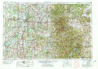
1956 Map of Vincennes
USGS Topo · Published 1978About this map
The confluence of the Wabash River and White River anchors this regional portrait of southwestern Indiana and southeastern Illinois. Established river towns like Vincennes and Mt. Carmel appear alongside the heavy industrial footprint of Strip Mines in the coal-rich counties of Pike and Warrick. The landscape transitions from the broad floodplains of the west to the dense woodlands of the Hoosier National Forest and the Crane Naval Ammunition Depot in the east.
Find a feature on this map
81 named features on this map. Tap any name to fly to it.
Don’t see what you’re looking for? This feature index may not catch every label — zoom into the map to look around manually.
Map Details
Editions of this 1956 Vincennes Map
4 editions found

Other maps of this area

1900 · St Meinrad
USGS Topo · 1:62,500

1900 · De Gonia Springs
USGS Topo · 1:62,500

1901 · Owensboro
USGS Topo · 1:62,500

1901 · Princeton
USGS Topo · 1:62,500

1901 · Haubstadt
USGS Topo · 1:62,500

1902 · Ditney
USGS Topo · 1:125,000

1902 · Degonia Springs
USGS Topo · 1:62,500

1902 · Boonville
USGS Topo · 1:62,500

1903 · St. Meinrad
USGS Topo · 1:62,500

1903 · Velpen
USGS Topo · 1:62,500