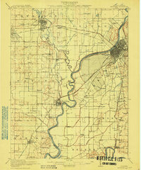
1915 Map of Vincennes
USGS Topo · Published 1915About this map
The Wabash River meanders across the landscape, serving as a natural boundary between Illinois and Indiana. On the Indiana side, Vincennes stands as a significant rail and trade hub, while the vast Vincennes Common to its south reveals a structured agricultural layout. To the west in Illinois, Lawrenceville and St Francisville are connected by a dense network of early 20th-century railroads, including the Baltimore and Ohio Southwestern and the Cleveland Cincinnati Chicago and St Louis.
Find a feature on this map
91 named features on this map. Tap any name to fly to it.
Don’t see what you’re looking for? This feature index may not catch every label — zoom into the map to look around manually.
Map Details
Editions of this 1915 Vincennes Map
5 editions found
Other maps of this area

1901 · Princeton
USGS Topo · 1:62,500

1902 · Ditney
USGS Topo · 1:125,000

1903 · Petersburg
USGS Topo · 1:62,500

1903 · Princeton
USGS Topo · 1:62,500

1903 · Patoka
USGS Topo · 1:125,000

1904 · Mount Carmel
USGS Topo · 1:62,500

1910 · Hardinville
USGS Topo · 1:62,500

1911 · Sumner
USGS Topo · 1:62,500

1913 · Sumner
USGS Topo · 1:62,500

1915 · Vincennes
USGS Topo · 1:62,500