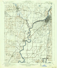
1915 Map of Vincennes
USGS Topo · Published 1934About this map
Vincennes and Lawrenceville anchor this 1910s survey of the Wabash River valley, a landscape shaped by the shifting waters of the Wabash River and its major tributaries, the Embarrass River and White River. The terrain is characterized by ancient river remnants such as Beaver Pond, Otter Pond, and Rapid Pond, alongside the unique sandy elevations of the Sand Ridge and the broad Vincennes Common.
Find a feature on this map
92 named features on this map. Tap any name to fly to it.
Don’t see what you’re looking for? This feature index may not catch every label — zoom into the map to look around manually.
Map Details
Editions of this 1915 Vincennes Map
5 editions found
Other maps of this area

1901 · Princeton
USGS Topo · 1:62,500

1902 · Ditney
USGS Topo · 1:125,000

1903 · Petersburg
USGS Topo · 1:62,500

1903 · Princeton
USGS Topo · 1:62,500

1903 · Patoka
USGS Topo · 1:125,000

1904 · Mount Carmel
USGS Topo · 1:62,500

1910 · Hardinville
USGS Topo · 1:62,500

1911 · Sumner
USGS Topo · 1:62,500

1913 · Sumner
USGS Topo · 1:62,500

1915 · Vincennes
USGS Topo · 1:62,500