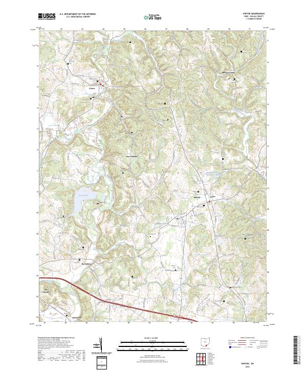
2023 Map of Vinton
USGS Topo · Published 2023About this map
Vinton and the surrounding Gallia County landscape are defined by the winding course of Raccoon Creek, which draws a deep, branching path through this section of southern Ohio. The area is dense with family and community burial sites, including the Vinton Memorial Cem, the Upper McCarley Cem, and the Morgan Center Cem, reflecting generations of rural settlement. To the west, Tycoon Lake provides a significant water feature amidst the complex drainage of Trace Run and Barren Creek. Smaller hamlets like Morgan Center, Bidwell, and Porter are connected by a network of township and county roads, such as Woods Mill Rd and Jackson St, that follow the natural contours of the stream valleys. This 2023 data illustrates the modern layout of these established rural communities, maintaining their historical spatial relationships even as transportation infrastructure like Adamsville Rd has evolved.
Find a feature on this map
133 named features on this map. Tap any name to fly to it.
Don’t see what you’re looking for? This feature index may not catch every label — zoom into the map to look around manually.
Map Details
Editions of this 2023 Vinton Map
This is the sole edition of this map. No revisions or reprints were ever made.
Other maps of this area

1905 · Wilkesville
USGS Topo · 1:62,500

1906 · Bidwell
USGS Topo · 1:62,500

1907 · Pomeroy
USGS Topo · 1:62,500

1908 · Bidwell
USGS Topo · 1:62,500

1908 · Point Pleasant
USGS Topo · 1:62,500

1908 · Wilkesville
USGS Topo · 1:62,500

1926 · Point Pleasant
USGS Topo · 1:62,500

1929 · Point Pleasant
USGS Topo · 1:62,500

1947 · Columbus
USGS Topo · 1:250,000

1957 · Huntington
USGS Topo · 1:250,000