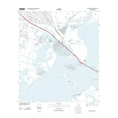
2013 Map of Virginia Point
USGS Topo · Published 2013About this map
The Galveston Causeway anchors this coastal landscape, serving as a critical artery across the salt marshes and inlets of the Texas Gulf Coast. Near the mainland approach at Virginia Point, the map reveals a complex network of coastal communities and industrial infrastructure. The residential patterns of La Marque and the planned waterfront developments of Bayou Vista and Tiki Island stand in contrast to the marshy expanse of Jones Bay and West Bay.
Find a feature on this map
52 named features on this map. Tap any name to fly to it.
Don’t see what you’re looking for? This feature index may not catch every label — zoom into the map to look around manually.
Map Details
Editions of this 2013 Virginia Point Map
This is the sole edition of this map. No revisions or reprints were ever made.
Other maps of this area

1929 · Dickinson
USGS Topo · 1:24,000

1929 · Karankawa Lake
USGS Topo · 1:24,000

1929 · Hitchcock
USGS Topo · 1:24,000

1929 · Virginia Point
USGS Topo · 1:24,000

1929 · Texas City
USGS Topo · 1:24,000

1930 · Galveston
USGS Topo · 1:24,000

1931 · Lake Como
USGS Topo · 1:24,000

1932 · Dickinson
USGS Topo · 1:31,680

1932 · Texas City
USGS Topo · 1:31,680

1932 · Bolivar Point
USGS Topo · 1:24,000