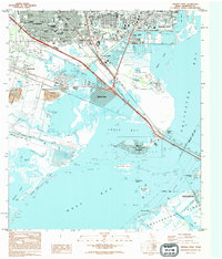
1994 Map of Virginia Point
USGS Topo · Published 1994About this map
The industrial and coastal interface of Texas City and the northern reaches of Galveston Island define this 1990s-era coastal landscape. This survey documents a complex network of man-made waterways and reclaimed land, centered on the Village of Tiki Island and the residential finger canals of Bayou Vista. Further inland, the urban development of La Marque and Highland is marked by a concentration of community landmarks, including Rising Star Cem, First United Methodist, and several local schools.
Find a feature on this map
47 named features on this map. Tap any name to fly to it.
Don’t see what you’re looking for? This feature index may not catch every label — zoom into the map to look around manually.
Map Details
Editions of this 1994 Virginia Point Map
This is the sole edition of this map. No revisions or reprints were ever made.
Other maps of this area

1929 · Dickinson
USGS Topo · 1:24,000

1929 · Karankawa Lake
USGS Topo · 1:24,000

1929 · Hitchcock
USGS Topo · 1:24,000

1929 · Virginia Point
USGS Topo · 1:24,000

1929 · Texas City
USGS Topo · 1:24,000

1930 · Galveston
USGS Topo · 1:24,000

1931 · Lake Como
USGS Topo · 1:24,000

1932 · Dickinson
USGS Topo · 1:31,680

1932 · Texas City
USGS Topo · 1:31,680

1932 · Bolivar Point
USGS Topo · 1:24,000