
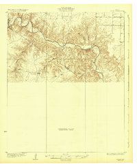
1932 Map of Vivian
USGS Topo · Published 1932About this map
Pease River carves a deep, winding course through this section of North Texas, forming a natural boundary between several counties. Surveyed in the late 1920s, this sheet reveals a landscape defined by dramatic elevation changes and a sparse settlement pattern characteristic of the rolling plains near Teacup Mountain. While much of the southern portion remained a Preliminary Edition Unsurveyed Area at the time of publication, the northern sections show a network of section lines and rural infrastructure. A single educational hub, the Forestburg Sch, serves as a primary social landmark in the northeast, situated near the headwaters of various seasonal drainages. The convergence of Yampareka Creek and the river valley illustrates the complex topography that early ranchers and surveyors navigated in this part of the state.
Find a feature on this map
8 named features on this map. Tap any name to fly to it.
Don’t see what you’re looking for? This feature index may not catch every label — zoom into the map to look around manually.
Map Details
Editions of this 1932 Vivian Map
2 editions found
Other maps of this area

1927 · Quanah 3-a
USGS Topo · 1:48,000

1927 · Quanah 3-b
USGS Topo · 1:48,000

1954 · Lubbock
USGS Topo · 1:250,000

1954 · Plainview
USGS Topo · 1:250,000

1954 · Wichita Falls
USGS Topo · 1:250,000

1955 · Lawton
USGS Topo · 1:250,000

1958 · Wichita Falls
USGS Topo · 1:250,000

1958 · Plainview
USGS Topo · 1:250,000

1958 · Medicine Mound
USGS Topo · 1:62,500

1960 · Goodlett
USGS Topo · 1:62,500