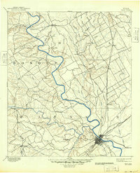
1955 Map of Waco
USGS Topo · Published 1955This historical map portrays the area of Waco in 1955, primarily covering McLennan County as well as portions of Burnet County, Leon County, Madison County, Bell County, Hill County, Hamilton County, Milam County, Limestone County, Coryell County, Lampasas County, Freestone County, Anderson County, Bosque County, Falls County, Navarro County, and Robertson County. Featuring a scale of 1:250000, this map provides a highly detailed snapshot of the terrain, roads, buildings, counties, and historical landmarks in the Waco region at the time. Published in 1955, it is the sole known edition of this map.
Find a feature on this map
70 named features on this map. Tap any name to fly to it.
Don’t see what you’re looking for? This feature index may not catch every label — zoom into the map to look around manually.
Map Details
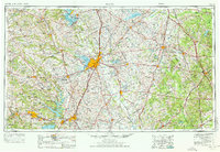
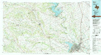
Editions of this 1955 Waco Map
This is the sole edition of this map. No revisions or reprints were ever made.
Historical Maps of Blue Ridge Through Time
5 maps found