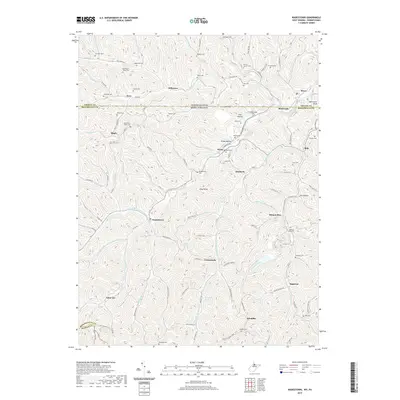
2019 Map of Wadestown
USGS Topo · Published 2019About this map
Wadestown and the surrounding rural landscape of the Pennsylvania-West Virginia border are meticulously documented in this 2019 survey. The area is defined by a dense network of cemeteries and small communities, including Jollytown, Saint Leo, and Klondike, reflecting generations of settlement along the complex drainage of the Pennsylvania Fork Dunkard Cr and Miracle Run. Genealogists will find significant value in the numerous family-named burial grounds like Meighen Cem, Handgardner Cem, and Cumberledge Cem that dot the ridgelines and valleys. High points such as Efaw Knob and McFeeters Knob overlook a terrain carved by Browns Run and Honey Run, where old routes like Jollytown Rd and Wadestown Rd still connect these long-standing Appalachian hamlets.
Find a feature on this map
129 named features on this map. Tap any name to fly to it.
Don’t see what you’re looking for? This feature index may not catch every label — zoom into the map to look around manually.
Map Details
Editions of this 2019 Wadestown Map
This is the sole edition of this map. No revisions or reprints were ever made.
Other maps of this area

1901 · Waynesburg
USGS Topo · 1:62,500

1904 · Blacksville
USGS Topo · 1:62,500

1904 · Waynesburg
USGS Topo · 1:62,500

1905 · Mannington
USGS Topo · 1:62,500

1905 · Rogersville
USGS Topo · 1:62,500

1923 · Blacksville
USGS Topo · 1:62,500

1923 · Mannington
USGS Topo · 1:62,500

1925 · Blacksville
USGS Topo · 1:62,500

1926 · Mannington
USGS Topo · 1:62,500

1949 · Clarksburg
USGS Topo · 1:250,000