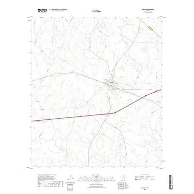
2019 Map of Waelder
USGS Topo · Published 2019About this map
Waelder serves as the central hub of this South Texas landscape, situated along the border of Fayette Co and Gonzales Co. The town is organized around a grid of streets such as N Railroad St, Main St, and Avenue E, reflecting the historical importance of the rail corridor passing through its heart. Outside the settlement, the terrain is defined by a dense network of intermittent waterways that drain toward the south and east.
Find a feature on this map
63 named features on this map. Tap any name to fly to it.
Don’t see what you’re looking for? This feature index may not catch every label — zoom into the map to look around manually.
Map Details
Editions of this 2019 Waelder Map
This is the sole edition of this map. No revisions or reprints were ever made.
Other maps of this area

1901 · Flatonia
USGS Topo · 1:125,000

1953 · Seguin
USGS Topo · 1:250,000

1958 · Seguin
USGS Topo · 1:250,000

1962 · Dilworth
USGS Topo · 1:24,000
1962 · Gonzales North
USGS Topo · 1:24,000
1964 · Delhi
USGS Topo · 1:24,000
1964 · Sandy Fork
USGS Topo · 1:24,000

1964 · Waelder
USGS Topo · 1:24,000

1964 · Jeddo
USGS Topo · 1:24,000

1965 · Cistern
USGS Topo · 1:24,000