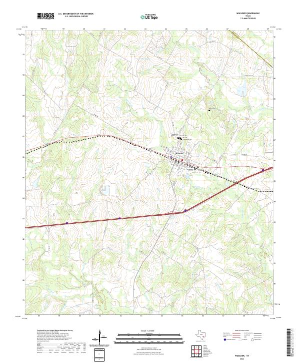
2022 Map of Waelder
USGS Topo · Published 2022About this map
The town of Waelder sits at the nexus of several creek systems in the northeastern corner of Gonzales County, where the landscape is carved by Sandy Fork, Baldridge Cr, and Copperas Cr. This 2022 survey details a dense concentration of local burial grounds within the immediate vicinity of the settlement, including the Hopkinsville Masonic Cem, Waelder Community Cem, and the Waelder Cementerio Bautista.
Find a feature on this map
64 named features on this map. Tap any name to fly to it.
Don’t see what you’re looking for? This feature index may not catch every label — zoom into the map to look around manually.
Map Details
Editions of this 2022 Waelder Map
This is the sole edition of this map. No revisions or reprints were ever made.
Other maps of this area

1901 · Flatonia
USGS Topo · 1:125,000

1953 · Seguin
USGS Topo · 1:250,000

1958 · Seguin
USGS Topo · 1:250,000

1962 · Dilworth
USGS Topo · 1:24,000
1962 · Gonzales North
USGS Topo · 1:24,000
1964 · Delhi
USGS Topo · 1:24,000
1964 · Sandy Fork
USGS Topo · 1:24,000

1964 · Waelder
USGS Topo · 1:24,000

1964 · Jeddo
USGS Topo · 1:24,000

1965 · Cistern
USGS Topo · 1:24,000