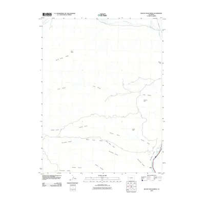
2010 Map of Wagon Track Ridge
USGS Topo · Published 2010About this map
Wagon Track Ridge and South Shale Ridge define the high-elevation terrain of this western Colorado landscape. The Colorado River cuts through the southeastern corner, carving the dramatic De Beque Canyon near the small settlement of Akin. The area is characterized by deep drainage systems like Sulphur Gulch and Coon Hollow, which feed into the Dry Fork Roan Creek to the north. These drainages are flanked by prominent geological formations, including Pyramid Rock, Castle Rock, and Twin Peaks.
Find a feature on this map
26 named features on this map. Tap any name to fly to it.
Don’t see what you’re looking for? This feature index may not catch every label — zoom into the map to look around manually.
Map Details
Editions of this 2010 Wagon Track Ridge Map
This is the sole edition of this map. No revisions or reprints were ever made.
Other maps of this area

1929 · Grand Valley
USGS Topo · 1:62,500

1929 · Roan Creek
USGS Topo · 1:62,500

1955 · Cameo
USGS Topo · 1:24,000

1955 · Mesa
USGS Topo · 1:24,000

1956 · Grand Junction
USGS Topo · 1:250,000

1959 · Grand Junction
USGS Topo · 1:250,000

1960 · Grand Junction
USGS Topo · 1:250,000

1962 · Grand Junction
USGS Topo · 1:250,000
1962 · Red Pinnacle
USGS Topo · 1:24,000
1962 · De Beque
USGS Topo · 1:24,000