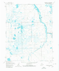
1955 Map of Wainwright A-2
USGS Topo · Published 1980About this map
The Kuk River and its numerous tributaries dominate this mid-century landscape in the National Petroleum Reserve in Alaska. The map documents a territory defined by complex drainage patterns, where the Kaolak River and Avalik River converge amidst a dense network of smaller streams like Ikpitcheak Creek and Adrigigon Creek. Evidence of seasonal Arctic travel and early exploration is visible through the Tractor Trail and Winter Trail systems that navigate the low-lying terrain.
Find a feature on this map
16 named features on this map. Tap any name to fly to it.
Don’t see what you’re looking for? This feature index may not catch every label — zoom into the map to look around manually.
Map Details
Editions of this 1955 Wainwright A-2 Map
2 editions found
Other maps of this area

1951 · Utukok River
USGS Topo · 1:250,000

1951 · Wainwright
USGS Topo · 1:250,000

1955 · Wainwright
USGS Topo · 1:250,000

1955 · Wainwright A-2
USGS Topo · 1:63,360
1955 · Utukok River D-3
USGS Topo · 1:63,360

1955 · Wainwright B-1
USGS Topo · 1:63,360
1955 · Wainwright A-3
USGS Topo · 1:63,360
1955 · Wainwright B-2
USGS Topo · 1:63,360
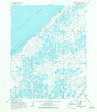
1955 · Wainwright B-3
USGS Topo · 1:63,360
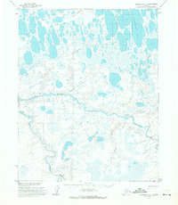
1955 · Wainwright A-1
USGS Topo · 1:63,360