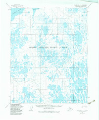
1955 Map of Wainwright B-1
USGS Topo · Published 1984About this map
The National Petroleum Reserve In Alaska dominates this landscape on the North Slope, where the terrain is defined by a complex network of thaw lakes and meandering watercourses. This mid-century survey captures the hydrologic patterns of the Arctic coastal plain before significant modern industrial development, showing the braided paths of the Kungok River and the Maguriak River.
Find a feature on this map
9 named features on this map. Tap any name to fly to it.
Don’t see what you’re looking for? This feature index may not catch every label — zoom into the map to look around manually.
Map Details
Editions of this 1955 Wainwright B-1 Map
3 editions found
Other maps of this area

1951 · Meade River
USGS Topo · 1:250,000

1951 · Wainwright
USGS Topo · 1:250,000

1955 · Wainwright
USGS Topo · 1:250,000

1955 · Wainwright A-2
USGS Topo · 1:63,360

1955 · Wainwright B-1
USGS Topo · 1:63,360

1955 · Meade River
USGS Topo · 1:250,000

1955 · Wainwright C-1
USGS Topo · 1:63,360
1955 · Meade River A-5
USGS Topo · 1:63,360

1955 · Meade River C-5
USGS Topo · 1:63,360
1955 · Meade River B-5
USGS Topo · 1:63,360