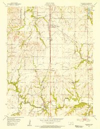
1955 Map of Wakarusa
USGS Topo · Published 1956About this map
Forbes Air Force Base dominates the central landscape south of Topeka, illustrating the significant military footprint in Shawnee County during the mid-1950s. The map captures a mix of evolving infrastructure and rural tradition, featuring the then-new Kansas Turnpike slicing through the western section. Traces of the region's earlier heritage are visible in the north, where the Potawatomi Indian Reservation Boundary is clearly marked.
Find a feature on this map
36 named features on this map. Tap any name to fly to it.
Don’t see what you’re looking for? This feature index may not catch every label — zoom into the map to look around manually.
Map Details
Editions of this 1955 Wakarusa Map
4 editions found
Other maps of this area

1889 · Burlingame
USGS Topo · 1:125,000

1889 · Topeka
USGS Topo · 1:125,000

1894 · Burlingame
USGS Topo · 1:125,000

1894 · Topeka
USGS Topo · 1:125,000

1947 · Lawrence
USGS Topo · 1:250,000

1950 · Kansas City
USGS Topo · 1:250,000

1950 · Lawrence
USGS Topo · 1:250,000

1950 · Topeka
USGS Topo · 1:24,000

1950 · Grantville
USGS Topo · 1:24,000

1951 · Grantville
USGS Topo · 1:24,000