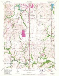
1955 Map of Wakarusa
USGS Topo · Published 1971About this map
Forbes Air Force Base dominates the central landscape of this Shawnee County survey, illustrating the significant military footprint in the region during the mid-century. To the north, the Potawatomi Indian Reservation Boundary cuts across the terrain near the Kansas Turnpike, marking a historic division of land. The map captures a period of suburban expansion south of Topeka, evidenced by residential developments like Cullen Village and Terra Heights, while older community hubs such as Berryton and Pauline maintain their identities along the Missouri Pacific and Atchison Topeka and Santa Fe rail lines.
Find a feature on this map
36 named features on this map. Tap any name to fly to it.
Don’t see what you’re looking for? This feature index may not catch every label — zoom into the map to look around manually.
Map Details
Editions of this 1955 Wakarusa Map
4 editions found
Other maps of this area

1889 · Burlingame
USGS Topo · 1:125,000

1889 · Topeka
USGS Topo · 1:125,000

1894 · Burlingame
USGS Topo · 1:125,000

1894 · Topeka
USGS Topo · 1:125,000

1947 · Lawrence
USGS Topo · 1:250,000

1950 · Kansas City
USGS Topo · 1:250,000

1950 · Lawrence
USGS Topo · 1:250,000

1950 · Topeka
USGS Topo · 1:24,000

1950 · Grantville
USGS Topo · 1:24,000

1951 · Grantville
USGS Topo · 1:24,000