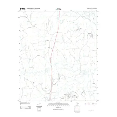
2013 Map of Wakefield
USGS Topo · Published 2013About this map
The Neches River forms the northern boundary of this landscape, winding through a complex of water features including the Dollarhide Cutoff and a large landform known simply as The Island. To the south, the settlement of Corrigan serves as a local hub near the junctions of several rural roads and the crossing of Piney Cr. The area is characterized by a network of creek systems, including Upper Sulphur Cr and Lower Sulphur Cr, which drain the timbered terrain.
Find a feature on this map
76 named features on this map. Tap any name to fly to it.
Don’t see what you’re looking for? This feature index may not catch every label — zoom into the map to look around manually.
Map Details
Editions of this 2013 Wakefield Map
This is the sole edition of this map. No revisions or reprints were ever made.
Other maps of this area

1927 · Lufkin 4-c
USGS Topo · 1:24,000

1932 · Manning
USGS Topo · 1:62,500

1953 · Palestine
USGS Topo · 1:250,000

1954 · Beaumont
USGS Topo · 1:250,000

1955 · Camden
USGS Topo · 1:62,500

1955 · New Willard
USGS Topo · 1:62,500

1957 · Beaumont
USGS Topo · 1:250,000

1957 · Palestine
USGS Topo · 1:250,000
1963 · Apple Springs
USGS Topo · 1:24,000
1963 · Diboll
USGS Topo · 1:24,000