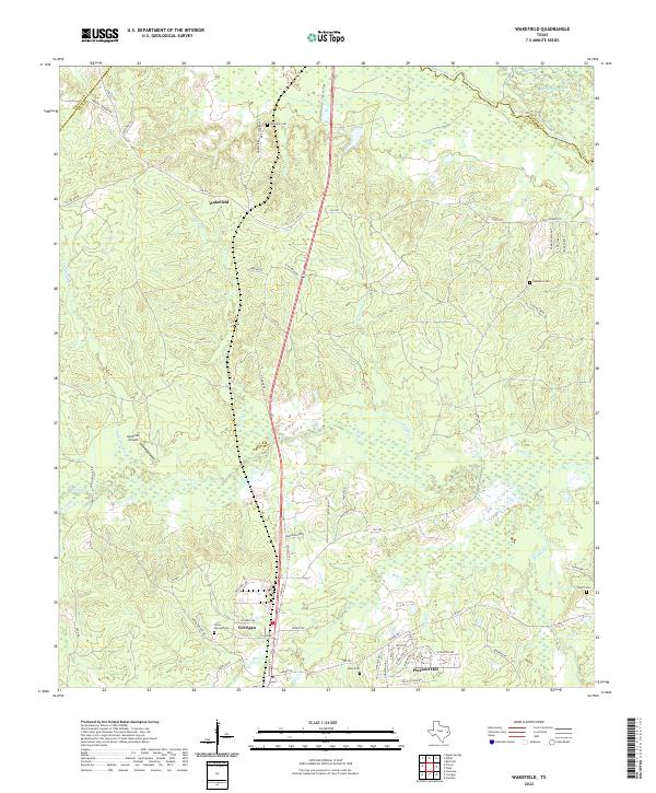
2022 Map of Wakefield
USGS Topo · Published 2022About this map
The Neches River forms a significant natural boundary in the northeastern corner of this Polk County landscape, accompanied by the distinctive Dollorhide Cutoff. The terrain is defined by a dense network of waterways, including Piney Cr, Upper Sulphur Cr, and Bear Cr, which shape the rural settlements of Wakefield and Corrigan. This 2022 survey illustrates the transition from river bottomlands to the interior timberlands, where small family and community cemeteries like Wheeler Cem, Damascus Cem, and Union Springs Cem serve as vital markers for local genealogists.
Find a feature on this map
70 named features on this map. Tap any name to fly to it.
Don’t see what you’re looking for? This feature index may not catch every label — zoom into the map to look around manually.
Map Details
Editions of this 2022 Wakefield Map
This is the sole edition of this map. No revisions or reprints were ever made.
Other maps of this area

1927 · Lufkin 4-c
USGS Topo · 1:24,000

1932 · Manning
USGS Topo · 1:62,500

1953 · Palestine
USGS Topo · 1:250,000

1954 · Beaumont
USGS Topo · 1:250,000

1955 · Camden
USGS Topo · 1:62,500

1955 · New Willard
USGS Topo · 1:62,500

1957 · Beaumont
USGS Topo · 1:250,000

1957 · Palestine
USGS Topo · 1:250,000
1963 · Apple Springs
USGS Topo · 1:24,000
1963 · Diboll
USGS Topo · 1:24,000