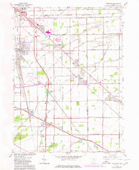
1965 Map of Walbridge
USGS Topo · Published 1980About this map
Industrial rail infrastructure and suburban expansion define this corner of Wood County during the mid-to-late 20th century. The massive Walbridge Yard serves as a focal point for the Conrail network, illustrating the area's importance as a transportation hub for Northwest Ohio. Residential pockets like Woodville Gardens, Cresceus Farms, and East Lawn are shown as they grew outward between the established villages of Walbridge and Millbury.
Find a feature on this map
55 named features on this map. Tap any name to fly to it.
Don’t see what you’re looking for? This feature index may not catch every label — zoom into the map to look around manually.
Map Details
Editions of this 1965 Walbridge Map
3 editions found
Other maps of this area

1900 · Maumee Bay
USGS Topo · 1:62,500

1900 · Toledo
USGS Topo · 1:62,500

1901 · Bowling Green
USGS Topo · 1:62,500

1901 · Elmore
USGS Topo · 1:62,500

1903 · Bowling Green
USGS Topo · 1:62,500

1903 · Elmore
USGS Topo · 1:62,500

1934 · Reno Beach
USGS Topo · 1:24,000

1934 · Point Place
USGS Topo · 1:24,000

1934 · Rossford
USGS Topo · 1:24,000

1935 · Walbridge
USGS Topo · 1:24,000