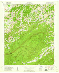
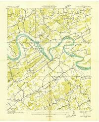
1953 Map of Walden Creek
USGS Topo · Published 1959About this map
Chilhowee Mountain and the Slate Knobs dominate this Tennessee landscape, where the boundary between Blount and Sevier counties follows the high ridges. In the early 1950s, rural life here centered on a dense network of small mountain communities and church-school hubs. The northern section is defined by the Chapman Highway passing through Cusick, while the Harrison Chilhowee Academy stands as a significant educational landmark near Boyds Creek. Southward, the terrain becomes more difficult, with settlements like Walden Creek and DuPont tucked into the gaps. A strong sense of local genealogy is preserved in the numerous family-named landmarks and country churches, including Zion Hill Church, Antioch Church, and the remote Chinquapin Church located near the southern edge. The map captures an era of winding mountain roads and spring-fed valleys before major modern development altered these traditional Appalachian communities.
Find a feature on this map
84 named features on this map. Tap any name to fly to it.
Don’t see what you’re looking for? This feature index may not catch every label — zoom into the map to look around manually.
Map Details
Editions of this 1953 Walden Creek Map
4 editions found
Other maps of this area

1886 · Knoxville
USGS Topo · 1:125,000

1892 · Knoxville
USGS Topo · 1:125,000

1894 · Knoxville
USGS Topo · 1:125,000

1895 · Knoxville
USGS Topo · 1:125,000

1901 · Knoxville
USGS Topo · 1:125,000

1935 · Knoxville
USGS Topo · 1:48,000

1935 · Walden Creek
USGS Topo · 1:24,000

1935 · Wildwood
USGS Topo · 1:24,000

1935 · Sevierville
USGS Topo · 1:48,000
1935 · Boyds Creek
USGS Topo · 1:24,000