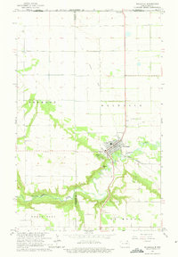
1964 Map of Walhalla
USGS Topo · Published 1975About this map
The Walhalla settlement serves as the focal point of this mid-century survey, positioned where the Pembina River winds through the borderlands of North Dakota. This landscape is defined by its proximity to the international boundary, marked by the US Customs Port of Entry in the north. The township shows a clear intersection of transport and industry, from the Great Northern rail line and the Walhalla Airport to an Old Railroad Grade that speaks to earlier transit routes. Topographical interest is found at Lookout Point, which overlooks the river's deep meanders and the surrounding townships of Fremont and La Moure. The map also meticulously identifies essential local infrastructure, including the Walhalla Cem, several gravel pits, and a Gaging Station monitoring the river's flow.
Find a feature on this map
23 named features on this map. Tap any name to fly to it.
Don’t see what you’re looking for? This feature index may not catch every label — zoom into the map to look around manually.
Map Details
Editions of this 1964 Walhalla Map
3 editions found
Other maps of this area

1918 · Walhalla
USGS Topo · 1:62,500

1943 · Walhalla
USGS Topo · 1:62,500

1952 · Thief River Falls
USGS Topo · 1:250,000

1953 · Devils Lake
USGS Topo · 1:250,000

1956 · Thief River Falls
USGS Topo · 1:250,000

1956 · Devils Lake
USGS Topo · 1:250,000

1957 · Thief River Falls
USGS Topo · 1:250,000

1964 · Hallson
USGS Topo · 1:24,000

1964 · Leroy
USGS Topo · 1:24,000

1964 · Walhalla
USGS Topo · 1:24,000