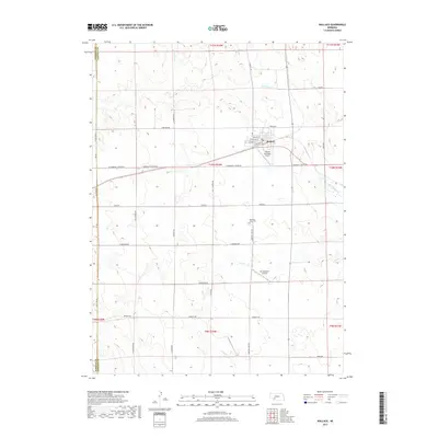
2017 Map of Wallace
USGS Topo · Published 2017About this map
Wallace serves as the central hub of this Nebraska high plains landscape, situated near the intersection of Community Center Rd and the northern reaches of Dry Cr. The town's grid is clearly defined by streets such as W Alice St and N Railroad St, reflecting its historical reliance on the rail corridor. Aviation plays a visible role in the local infrastructure, with both the Wallace Municipal Airport and the private Van Boening Airport located south of the main settlement.
Find a feature on this map
36 named features on this map. Tap any name to fly to it.
Don’t see what you’re looking for? This feature index may not catch every label — zoom into the map to look around manually.
Map Details
Editions of this 2017 Wallace Map
This is the sole edition of this map. No revisions or reprints were ever made.
Other maps of this area

1954 · McCook
USGS Topo · 1:250,000

1957 · McCook
USGS Topo · 1:250,000

1958 · McCook
USGS Topo · 1:250,000
1973 · Grainton
USGS Topo · 1:24,000

1973 · Dittons Creek NE
USGS Topo · 1:24,000

1973 · Suttlers Canyon West
USGS Topo · 1:24,000
1973 · Wallace NE
USGS Topo · 1:24,000
1973 · Melton Ranch Airport
USGS Topo · 1:24,000
1973 · Wallace NW
USGS Topo · 1:24,000
1973 · Wallace
USGS Topo · 1:24,000