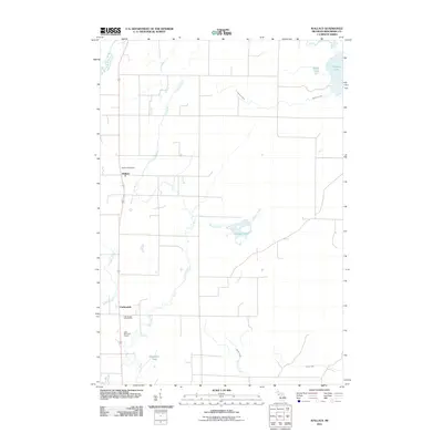
2011 Map of Wallace
USGS Topo · Published 2011About this map
Wallace and Carbondale serve as the primary settlement hubs in this portion of Menominee County, situated within a landscape defined by the parallel courses of the Little Cedar River and the Little River. The area's geography is intricately tied to its water, with numerous named drainages such as Lindberg Creek, Hayward Creek, and Beattie Creek feeding into the river systems. The local economy and social life are reflected in landmarks like the Wallace Post Office and recreational spaces including the Little Nugget Golf Course and Little Bear Golf Course. To the east, a cluster of glacial lakes including Hanson Lake, Myers Lake, and Hayward Lake suggests a terrain shaped by historical hydrology. This survey provides a clear view of the rural road network and township divisions that connect these small communities and family-named landmarks.
Find a feature on this map
18 named features on this map. Tap any name to fly to it.
Don’t see what you’re looking for? This feature index may not catch every label — zoom into the map to look around manually.
Map Details
Editions of this 2011 Wallace Map
This is the sole edition of this map. No revisions or reprints were ever made.
Other maps of this area

1939 · Marinette
USGS Topo · 1:48,000

1949 · Stephenson
USGS Topo · 1:48,000

1954 · Escanaba
USGS Topo · 1:250,000

1957 · Escanaba
USGS Topo · 1:250,000

1958 · Escanaba
USGS Topo · 1:250,000

1961 · Chambers Island
USGS Topo · 1:62,500

1963 · Cedar River
USGS Topo · 1:62,500
1963 · Birch Creek
USGS Topo · 1:24,000
1963 · Chappee Rapids
USGS Topo · 1:24,000

1963 · Stephenson
USGS Topo · 1:62,500