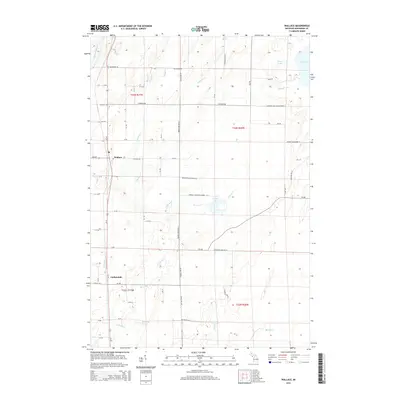
2014 Map of Wallace
USGS Topo · Published 2014About this map
Wallace and Carbondale anchor this section of Menominee County, reflecting a landscape defined by its glacial hydrology and systematic section-line road network. The Little Cedar River and the meandering Little River dominate the western half of the quadrangle, while a cluster of inland water bodies including Hanson Lake, Myers Lake, and Hayward Lake punctuate the eastern interior. The grid of roads, such as Co Road 346 and Range Line Dr M-1, follows the township and range lines of t34n r27w and surrounding boundaries, a clear indication of the late-stage rural development in Michigan's Upper Peninsula. Local history researchers will find specific interest in the named access points like Mission Church No 14 Ln and Hanson Lake Lane Number 13.5, which point to established community landmarks and seasonal settlements near the water's edge.
Find a feature on this map
59 named features on this map. Tap any name to fly to it.
Don’t see what you’re looking for? This feature index may not catch every label — zoom into the map to look around manually.
Map Details
Editions of this 2014 Wallace Map
This is the sole edition of this map. No revisions or reprints were ever made.
Other maps of this area

1939 · Marinette
USGS Topo · 1:48,000

1949 · Stephenson
USGS Topo · 1:48,000

1954 · Escanaba
USGS Topo · 1:250,000

1957 · Escanaba
USGS Topo · 1:250,000

1958 · Escanaba
USGS Topo · 1:250,000

1961 · Chambers Island
USGS Topo · 1:62,500

1963 · Cedar River
USGS Topo · 1:62,500
1963 · Birch Creek
USGS Topo · 1:24,000
1963 · Chappee Rapids
USGS Topo · 1:24,000

1963 · Stephenson
USGS Topo · 1:62,500