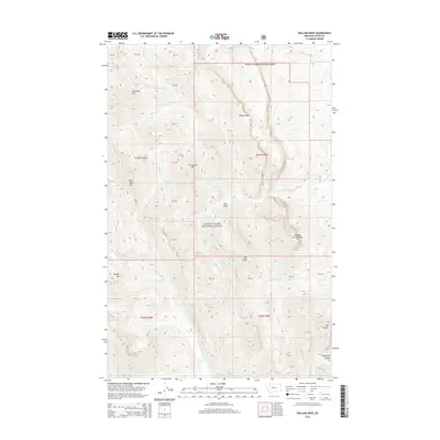
2014 Map of Walling Reef
USGS Topo · Published 2014About this map
Lewis & Clark National Forest encompasses the high country of the Front Range in this 2014 survey. The topography is dominated by the massive limestone escarpment of Walling Reef, a prominent landmark that rises above the surrounding drainages. The complex network of water features includes the headwaters of the N Fork Teton River and the S Fork Dupuyer Cr, which carve through the steep terrain to create Blackleaf Canyon. Numerous high peaks and named elevations like Mt Frazier, Hurricane Mtn, and the curiously named Old Man of the Hills define the wilderness character of the area. This map reveals a landscape largely untouched by modern development, where ancient geologic formations and seasonal creeks like Fright Cr and Washout Cr remain the primary points of reference.
Find a feature on this map
41 named features on this map. Tap any name to fly to it.
Don’t see what you’re looking for? This feature index may not catch every label — zoom into the map to look around manually.
Map Details
Editions of this 2014 Walling Reef Map
This is the sole edition of this map. No revisions or reprints were ever made.
Other maps of this area

1903 · Saypo
USGS Topo · 1:125,000

1914 · Heart Butte
USGS Topo · 1:125,000

1918 · Heart Butte
USGS Topo · 1:125,000

1955 · Choteau
USGS Topo · 1:250,000

1957 · Choteau
USGS Topo · 1:250,000

1958 · Choteau
USGS Topo · 1:250,000

1958 · Cave Mountain
USGS Topo · 1:24,000

1958 · Porphyry Reef
USGS Topo · 1:24,000

1958 · Mount Wright
USGS Topo · 1:24,000

1960 · Cut Bank
USGS Topo · 1:250,000