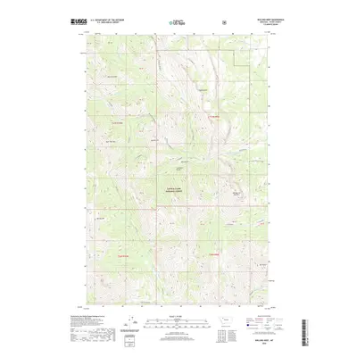
2020 Map of Walling Reef
USGS Topo · Published 2020About this map
Walling Reef and the Sawtooth Range dominate this high-elevation landscape within the Lewis & Clark National Forest. The map documents a complex drainage network where the N Fork Teton River and various forks of the N Fork Dupuyer emerge from the steep eastern slopes of the Rocky Mountains. The terrain is marked by distinctive geological formations such as Old Man of the Hills and Mt Frazier-Chicken Coulee, illustrating the transition from alpine peaks to the coulee-carved foothills of Teton County. Numerous family-named or colloquial landmarks like Hurricane Mtn, Bum Shot Mtn, and Bloody Hill suggest a history of early mountaineering, ranching, or local folklore in this wilderness. The presence of several public land survey parcels, including PB 40 and PB 41, provides essential data for researchers tracing land ownership and administrative history in northwestern Montana.
Find a feature on this map
48 named features on this map. Tap any name to fly to it.
Don’t see what you’re looking for? This feature index may not catch every label — zoom into the map to look around manually.
Map Details
Editions of this 2020 Walling Reef Map
This is the sole edition of this map. No revisions or reprints were ever made.
Other maps of this area

1903 · Saypo
USGS Topo · 1:125,000

1914 · Heart Butte
USGS Topo · 1:125,000

1918 · Heart Butte
USGS Topo · 1:125,000

1955 · Choteau
USGS Topo · 1:250,000

1957 · Choteau
USGS Topo · 1:250,000

1958 · Choteau
USGS Topo · 1:250,000

1958 · Cave Mountain
USGS Topo · 1:24,000

1958 · Porphyry Reef
USGS Topo · 1:24,000

1958 · Mount Wright
USGS Topo · 1:24,000

1960 · Cut Bank
USGS Topo · 1:250,000