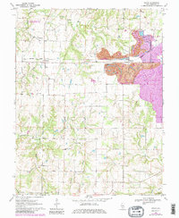
1970 Map of Walsh
USGS Topo · Published 1982About this map
Industrial activity and rural community life define this section of Randolph County during the early 1970s. The eastern portion of the map is dominated by the Peabody Coal Co Strip Mine, a massive landscape-altering operation that sits adjacent to the small settlement of Schuline. This industrial presence contrasts with the traditional agricultural layout found further west, where the Missouri Pacific railroad serves the grain and transit needs of communities like Walsh and Preston.
Find a feature on this map
23 named features on this map. Tap any name to fly to it.
Don’t see what you’re looking for? This feature index may not catch every label — zoom into the map to look around manually.
Map Details
Editions of this 1970 Walsh Map
3 editions found
Other maps of this area

1912 · Baldwin
USGS Topo · 1:62,500

1914 · Baldwin
USGS Topo · 1:62,500

1914 · Coulterville
USGS Topo · 1:62,500

1915 · Chester
USGS Topo · 1:62,500

1916 · Campbell Hill
USGS Topo · 1:62,500

1917 · Coulterville
USGS Topo · 1:62,500

1918 · Campbell Hill
USGS Topo · 1:62,500

1942 · Baldwin
USGS Topo · 1:62,500

1947 · Chester
USGS Topo · 1:62,500

1949 · Paducah
USGS Topo · 1:250,000