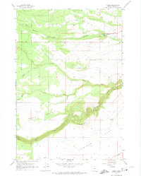
1962 Map of Wamic
USGS Topo · Published 1974About this map
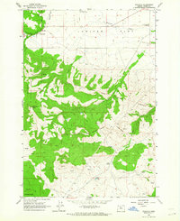
The White River carves a deep, winding canyon through the high plateau of Wasco County, separating the agricultural expanse of Juniper Flat from the forested slopes of the Mt Hood National Forest. In the early 1960s, the settlement of Wamic stands as a vital hub for this upland community, connected to the historical path of the Barlow Road. The landscape is a study in water management, where the Highland Ditch and Threemile Ditch draw from Threemile Creek to sustain the local farms. Genealogists and local historians can locate rural landmarks such as Smock Sch on the edge of Smock Prairie, and the isolated Graveyard Cem near Graveyard Butte. To the south, the village of Wapinitia anchors the southern reaches of the quadrangle where Wapinitia Creek meets the river's rugged drainage system.
Find a feature on this map
21 named features on this map. Tap any name to fly to it.
Don’t see what you’re looking for? This feature index may not catch every label — zoom into the map to look around manually.
Map Details
Editions of this 1962 Wamic Map
4 editions found
Other maps of this area

1930 · Dufur
USGS Topo · 1:125,000

1934 · Dufur
USGS Topo · 1:125,000

1953 · The Dalles
USGS Topo · 1:250,000

1956 · The Dalles
USGS Topo · 1:250,000

1957 · The Dalles
USGS Topo · 1:250,000

1962 · Rock Creek Reservoir
USGS Topo · 1:24,000

1962 · Postage Stamp Butte
USGS Topo · 1:24,000
1962 · Foreman Point
USGS Topo · 1:24,000

1962 · Wamic
USGS Topo · 1:24,000
1962 · Wapinitia
USGS Topo · 1:24,000