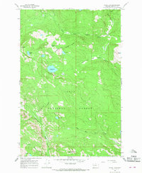
1965 Map of Wapiti Lake
USGS Topo · Published 1968About this map
The Lolo National Forest dominates this mid-1960s landscape, where the Flathead Indian Reservation Boundary cuts across high ridgelines and drainage basins. This area of Missoula County is defined by a network of high-altitude water bodies, including Boulder Lake, Wapiti Lake, and the remote Farmers Lakes at the southern edge. The topography is anchored by prominent summits such as Triangle Peak and Mineral Peak, the latter featuring a Lookout Tower that served as a critical vantage point for forest management and fire detection.
Find a feature on this map
21 named features on this map. Tap any name to fly to it.
Don’t see what you’re looking for? This feature index may not catch every label — zoom into the map to look around manually.
Map Details
Editions of this 1965 Wapiti Lake Map
3 editions found
Other maps of this area

1903 · Bonner
USGS Topo · 1:125,000

1921 · Elbow Lake
USGS Topo · 1:125,000

1947 · Butte
USGS Topo · 1:250,000

1955 · Choteau
USGS Topo · 1:250,000

1957 · Choteau
USGS Topo · 1:250,000

1958 · Butte
USGS Topo · 1:250,000

1958 · Choteau
USGS Topo · 1:250,000

1960 · Butte
USGS Topo · 1:250,000

1962 · Choteau
USGS Topo · 1:250,000

1962 · Butte
USGS Topo · 1:250,000