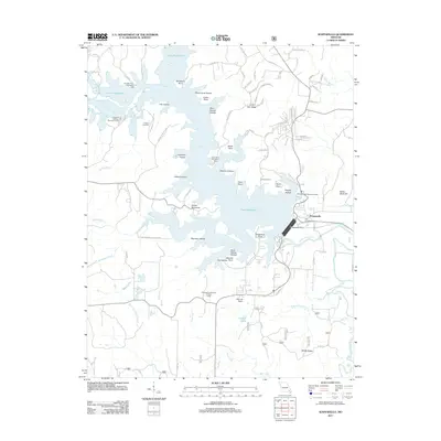
2011 Map of Wappapello
USGS Topo · Published 2011About this map
Lake Wappapello dominates this Missouri landscape, with its irregular shoreline creating a complex geography of peninsulas and points. This 2011 survey details the managed hydrology of the Saint Francis River below the Wappapello Dam. The map documents a blend of public recreation and specialized land use, ranging from the Lake Wappapello State Park and Camp Latonka to the University of Missouri Forestry Camp and the private Davis Air Ranch.
Find a feature on this map
84 named features on this map. Tap any name to fly to it.
Don’t see what you’re looking for? This feature index may not catch every label — zoom into the map to look around manually.
Map Details
Editions of this 2011 Wappapello Map
This is the sole edition of this map. No revisions or reprints were ever made.
Other maps of this area

1934 · Greenville
USGS Topo · 1:62,500

1934 · Puxico
USGS Topo · 1:62,500

1935 · Poplar Bluff
USGS Topo · 1:62,500

1935 · Zalma
USGS Topo · 1:62,500

1939 · Greenville
USGS Topo · 1:62,500

1939 · Puxico
USGS Topo · 1:62,500

1939 · Zalma
USGS Topo · 1:62,500

1939 · Poplar Bluff
USGS Topo · 1:62,500

1949 · Rolla
USGS Topo · 1:250,000

1949 · Poplar Bluff
USGS Topo · 1:62,500