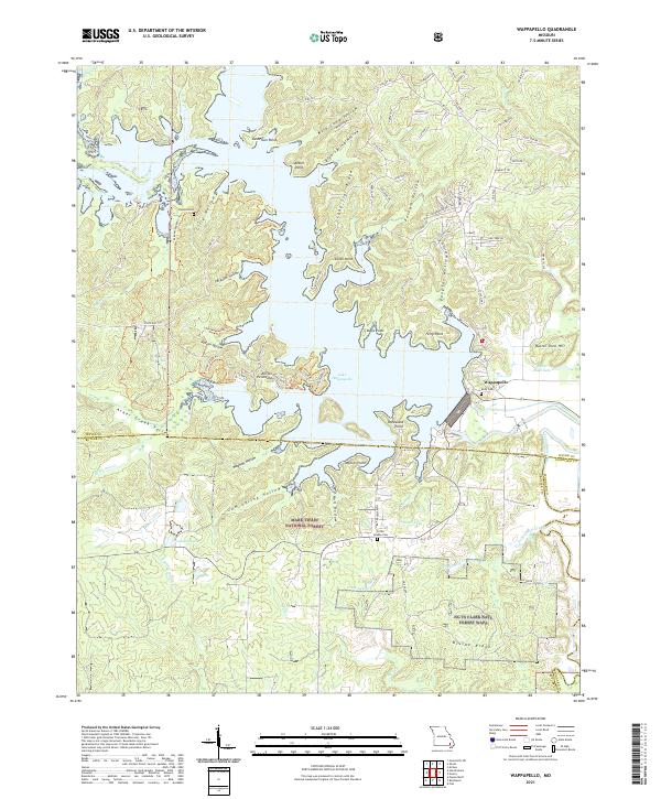
2021 Map of Wappapello
USGS Topo · Published 2021About this map
Lake Wappapello dominates this portion of the Missouri landscape, its complex shoreline defined by numerous points and hollows like Sanderson Point, Ferry Point, and Ferguson Hollow. The community of Wappapello sits at the lake's southeastern edge, positioned near the dam that controls the flow of the Saint Francis River. This area is heavily influenced by large-scale conservation efforts, with the map showing significant overlap between the Mark Twain National Forest, the Ng Ts Clark Natl Forest Wapp, and a portion of the Mingo National Wildlife Refuge.
Find a feature on this map
93 named features on this map. Tap any name to fly to it.
Don’t see what you’re looking for? This feature index may not catch every label — zoom into the map to look around manually.
Map Details
Editions of this 2021 Wappapello Map
This is the sole edition of this map. No revisions or reprints were ever made.
Other maps of this area

1934 · Greenville
USGS Topo · 1:62,500

1934 · Puxico
USGS Topo · 1:62,500

1935 · Poplar Bluff
USGS Topo · 1:62,500

1935 · Zalma
USGS Topo · 1:62,500

1939 · Greenville
USGS Topo · 1:62,500

1939 · Puxico
USGS Topo · 1:62,500

1939 · Zalma
USGS Topo · 1:62,500

1939 · Poplar Bluff
USGS Topo · 1:62,500

1949 · Rolla
USGS Topo · 1:250,000

1949 · Poplar Bluff
USGS Topo · 1:62,500