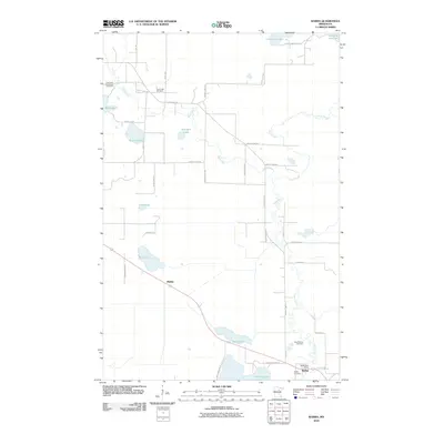
2010 Map of Warba
USGS Topo · Published 2010About this map
The Swan River meanders southward through this portion of Itasca County, defining a landscape punctuated by numerous glacial lakes and small settlements. The community of Warba serves as a local hub near the southern edge of the sheet, anchored by the Warba Post Office and nearby Feeley Cemetery. Further west, the settlement of Philbin sits along the primary highway corridor, south of Rice Lake.
Find a feature on this map
42 named features on this map. Tap any name to fly to it.
Don’t see what you’re looking for? This feature index may not catch every label — zoom into the map to look around manually.
Map Details
Editions of this 2010 Warba Map
This is the sole edition of this map. No revisions or reprints were ever made.
Other maps of this area

1920 · Trout Lake
USGS Topo · 1:62,500

1952 · Calumet
USGS Topo · 1:24,000

1952 · Pengilly
USGS Topo · 1:24,000

1952 · Bovey
USGS Topo · 1:24,000

1954 · Hibbing
USGS Topo · 1:250,000

1957 · Hibbing
USGS Topo · 1:250,000

1958 · Hibbing
USGS Topo · 1:250,000

1964 · Hibbing
USGS Topo · 1:250,000

1969 · La Prairie
USGS Topo · 1:24,000
1969 · Goodland
USGS Topo · 1:24,000